Maule, 2010 Chile Earthquake and Tsunami
The 2010 Chile earthquake occurred off the Maule coast of central Chile on Saturday, 27 February 2010, at 03:34 local time, having a magnitude of 8.8 on the moment magnitude scale, with intense shaking lasting for nearly four minutes. It occurred on the subduction zone plate boundary at the Peru - Chile Trench where the oceanic Nazca Plate subducts beneath the continental South American Plate. The two plates are converging at a rate of 80 mm per year. The epicentre was just 70 miles (115 kilometres) from Concepcion, Chile's second-largest city.
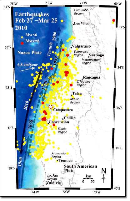
The 2010 Chile earthquake ranks as the sixth largest earthquake ever to be recorded by a seismograph. It was the most powerful tremor to hit Chile in 50 years. It was felt strongly in six Chilean regions (from Valparaiso in the north to Araucania in the south), that together make up about 80 percent of the country's population. According to the United States Geological Survey (USGS), the cities experiencing the strongest shaking at grade VIII (Destructive) on the Mercalli intensity scale (MM) were Arauco and Coronel. According to Chile's Seismological Service, Concepcion experienced the strongest shaking at MM IX (Violent).
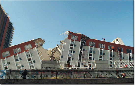
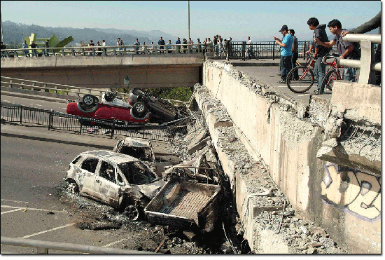
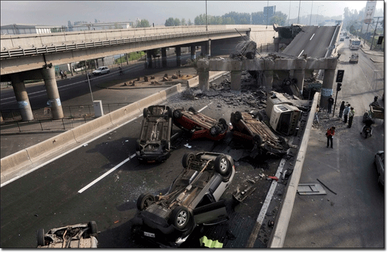
The earthquake was felt in the capital Santiago at MM VII (Very Strong) and MM VIII (Destructive).
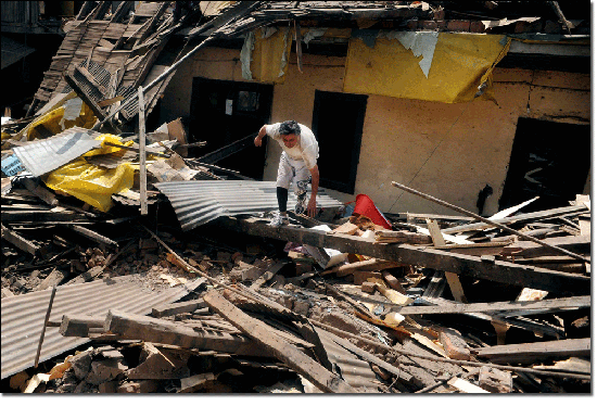
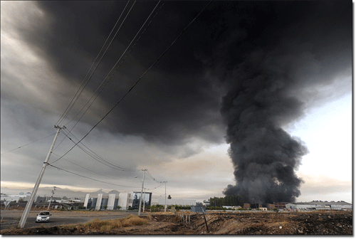
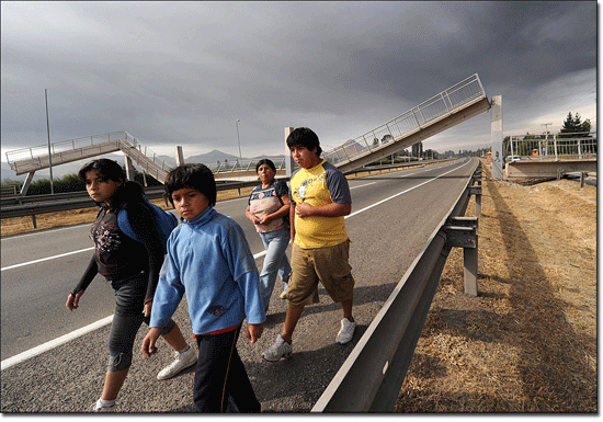
Tremors were felt in many Argentine cities, including Buenos Aires, Cordoba, Mendoza and La Rioja. Tremors were felt as far north as the city of Ica in southern Peru (approx. 2400 km).
The tsunami waves that followed this event affected the coastal regions between the cities of Valparaiso and Valdivia, with minor effects as far as Coquimbo. The tsunami devastated several coastal towns from Tirua to Pichilemu (spanning over 500 Km.) and damaged the port at Talcahuano.
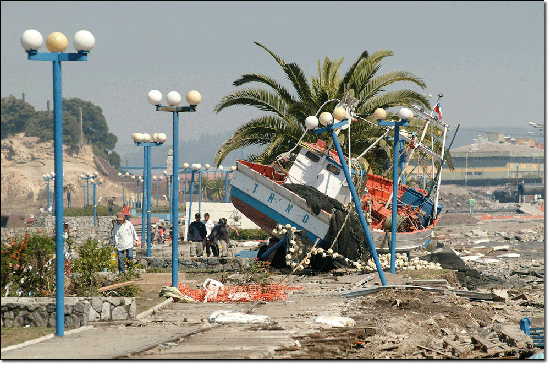
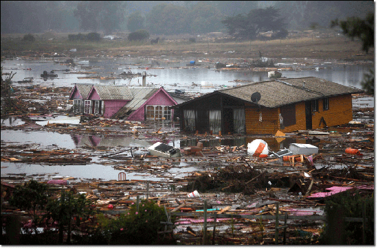
According to field observations tsunami heights reached ca. 14 m in the coastal area of the Maule region immediately north of the epicentre, and diminished progressively northwards to 4-2 m near Valparaiso. Along the coast of Cobquecura, tsunami height values were inferior to 2-4 m.
More variable tsunami heights of 6-8 m were measured at Dichato-Talcahuano and Tirua-Puerto Saavedra, in the Bio Bio and Arauco regions, respectively, to the south of the epicentre. According to eyewitnesses, the tsunami reached the coast between 12 to 20 and 30 to 45 minutes in areas located closer and faraway from the earthquake rupture zone, respectively.
Destructive tsunami waves arrived also between 2.5 and 4.5 hours after the main shock, especially along the coast of the Bio Bio and Arauco regions. The tsunami effects were highly variable along the coast, as a result of geomorphological and bathy-metric local conditions, besides potential complexities induced by the main shock.
The earthquake-triggered tsunami radiated across the Pacific basin and swamped Chile's sparsely inhabited Juan Fernandez Islands, the island chain that inspired the story of Robinson Crusoe, killing at least 8 people.
Tsunami warnings were issued in 53 countries, and the wave caused minor damage in the San Diego area of California and in the Tohoku region of Japan, where damage to the fisheries business was estimated at Yen 6.26 billion (US $66.7 million).
Steve Wollf, the author of this video, says: "San Diego was the first point in the US to be subjected to the tsunami (hence it would receive the largest waves). A friend of mine visiting from out of town decided to brave the storm and check it out. We were doubtful that we'd see anything at all, but decided to head to Point Loma, a spit of land that extends furthest out into the ocean and overlooks San Diego. From our comfortable and scenic perch about 300ft above sea level, this video shows what we saw before and during the tsunami. We later checked the times with the ranger station, so what we saw coincided time-wise with the tsunami event. Fortunately, San Diego was spared. My commiserations to the victims of this latest earthquake in Chile."
In Chile 525 people lost their lives, 25 people went missing and about 9% of the population in the affected regions lost their homes. According to Ministry of Interior data in May 2010, 124 of the 550 identified casualties and missing were attributed to the tsunami.
On 10 March, Swiss Reinsurance Co. estimated that the Chilean quake and tsunami would cost the insurance industry between 4 and 7 billion dollars. The rival German-based Munich Re AG made the same estimate. Earthquake's losses to economy of Chile are estimated at US $15-30 billion.
Did you know that..
The 2010 Chile earthquake and tsunami destroyed over 81,000 houses, and another 109,000 were severely damaged.
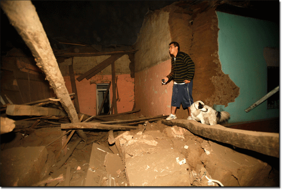
The earthquake generated a blackout in Chile that affected 93 percent of the country's population and which went on for several days in some locations. Restoring power in many cities in the immediate aftermath was impossible because of damage from the tsunami.

