1960 Valdivia Earthquake or Great Chilean Earthquake
The 1960 Valdivia earthquake or Great Chilean Earthquake of Sunday, 22 May 1960 is to date the most powerful megathrust earthquake ever recorded on Earth, rating 9.5 on the moment magnitude scale. Megathrust earthquakes generate tsunamis (known as teletsunamis) that can cross entire oceans. The Great Chilean Earthquake occurred in the afternoon (15:11 local time) and its resulting tsunami affected southern Chile, Hawaii, Japan, the Philippines, eastern New Zealand, southeast Australia, and the Aleutian Islands in Alaska.
The epicenter was some 570 km south of Santiago, with Temuco being the closest large city, while Valdivia was the most affected city.

The temblor caused localised tsunamis that severely battered the Chilean coast, with waves up to 25 metres.
Waves as high as 10.7 metres (35 ft) were recorded 10,000 kilometres from the epicenter, and as far away as Japan and the Philippines. The Chilean tsunami caused death and destruction throughout the Pacific. Hawaii, Samoa, and Easter Island all recorded runups exceeding 4 m.
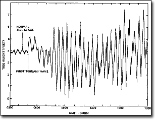
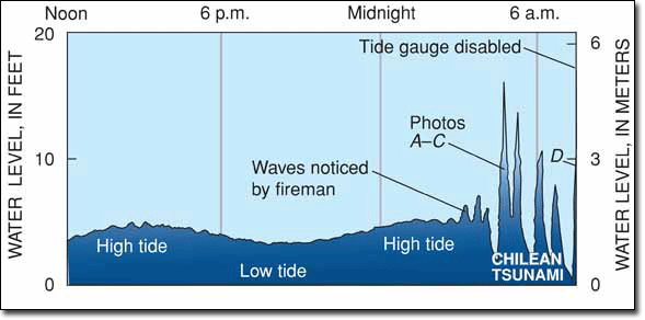
The first waves were less than half a metre high but three hours later many oscillations of about 1.5m occurred. With some 20 crests in 10 hours, the waves oscillated quite slowly but regularly. Perturbations of this nature cause large coastal and harbour currents. Compared with a typical tidal oscillation of 2m in 12.4 hours, the tsunami currents could have been 15 times stronger than normal tidal currents.
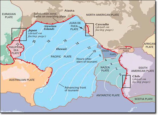
The source of this earthquake in 1960 extended over a distance of about 1,100 kilometres along the southern Chilean coast. Seismic sea waves excited by the earthquake caused death and destruction in Hawaii, Japan, and the Pacific coast of the United States.
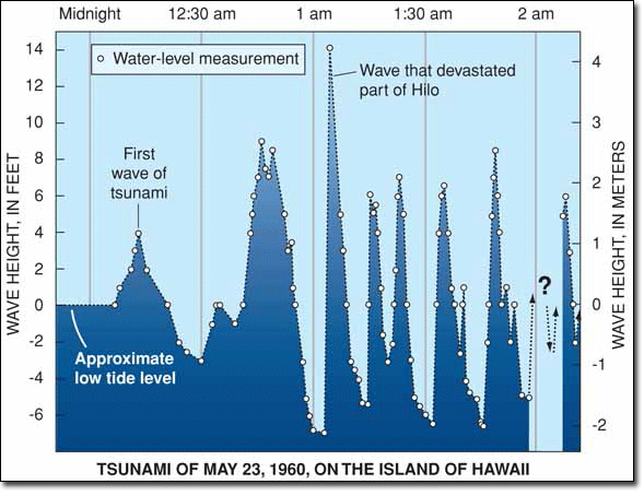
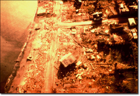
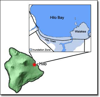
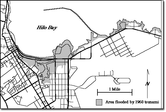
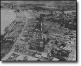
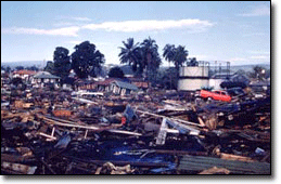
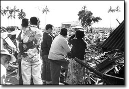
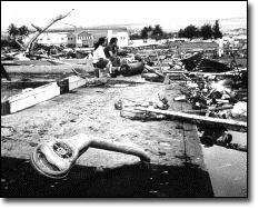
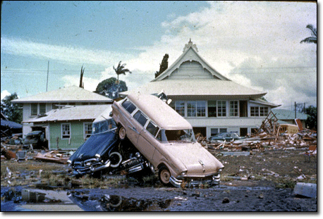
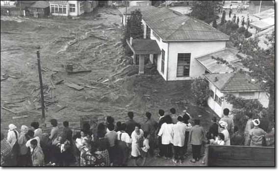
The main tsunami crossed the Pacific Ocean at a speed of several hundred km/h and on May 23, 1960 (about 15 hours after the earthquake) a train of 35-foot waves reached the Hawaiian Islands and crashed into Hilo Bay. Hilo's position in the bay caused a cumulative bounce of tsunami waves far more destructive to Hilo than to other more exposed areas of Hawaii.
The tsunami destroyed or damaged more than 500 homes and businesses downtown and killed 61 people. 282 people were badly hurt. The section of Hilo known as Waiakea was almost completely demolished and had to be cleared after the tsunami. Damage was estimated at $75 million.
This tsunami caused little damage elsewhere in the Hawaiian Islands, where wave heights were in the 3-17 foot range.
In Japan, the tsunami arrived about 22 hours after the earthquake and 138 people were killed. The tsunami also struck the Philippines, where 32 people were dead or missing.
The death toll and monetary losses arising from such a widespread disaster are not certain. Various estimates of the total number of fatalities from the earthquake and tsunamis have been published, with the USGS citing studies with figures of 2231, 3000, or 5700 killed and another source uses an estimate of 6000 dead. Different sources have estimated the monetary cost ranged from 400 million to 800 million US$ (or 2.9 to 5.8 billion in 2011 dollars, adjusted for inflation).
Did you know that..
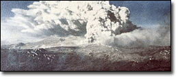
On 24 May 38 hours after the main shock of the 1960 Valdivia earthquake, Cordon Caulle volcano in Chile began an eruption which ended on 22 July.
Each tsunami consists of a succession of waves that arrive from 12 to 20 minutes apart. The 1960 tsunami had eight separate waves that crested between 4 and 14 feet above sea level at the Wailuku River Bridge. The first wave is not necessarily the largest and each wave may crest higher at different locations. Each tsunami may also have its maximum crest at a different location. This fact contributed to many deaths in Hilo in 1960, because people remained in the Waiakea peninsula area, which had minimal damage during the even larger 1946 tsunami.